Assiniboine Delta & Pembina Valley
GLENBORO SOUTH CYPRESS TRAIL
Geographical Location: Northern boundary of RM to southern boundary of Spruce Woods. Treaty 1.
Length: 42 km / 26 miles
Trail Types: gravel trail, gravel road, paved road
Trail Activities: hike, bike, horse, ski, snowshoe
There is a gap of approximately 10 km between the south end of the Carberry North Cypress Trail section and Spruce Woods Provincial Park, requiring you to follow Highway 5 until you reach the Epinette Creek parking lot, where the trail picks up again. The trail runs through the RM of South Cypress and Spruce Woods Provincial Park, ending at the southern boundary of the park (6 ½ km north of the Cypress River).
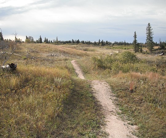
The trail passes through mixed-grass prairie, a transition zone between the endangered tall-grass prairie of the east and the short-grass prairie of the west. Big Bluestem, the plant that gives tall-grass prairie its name, stretches 2 m high in some areas including the edge of Spirit Sands. In other places, Pincushion Cacti are almost unnoticeable until their magenta blossoms open. The Western Hognose Snake can sometimes be found where the prairie meets forest or open sand; while the northern Prairie Skink, Manitoba’s only lizard, can be found on grassy hillsides.
CAUTION:
When following roadways, trail users should always remain on the shoulder (may not be paved). It is recommended that you only use roadways during daylight hours and under appropriate weather conditions.
ONLINE RESOURCES:
https://tctrail.ca/explore-the-map/
https://www.gov.mb.ca/sd/parks/park-maps-and-locations/western/spruce.html